Aboute route
Route description:
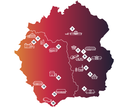
The car (and bike) route „Cieszyn Silesia – a common history of wood, iron and people” runs along existing roads around the Czantoria and Stożek ranges on both sides of the Polish-Czech border. The length of the route including the drive to the individual points is approx. 85 kilometres. The trail runs from Třinec to Vendryně, then through Bystřice to Nýdek and through Košařiska, Milíkov and Bocanovice to Dolná Lomná and Mosty u Jablunkova. It then leads to Jablunkov, through Písek to Jaworzynka and Istebna Andziołówka, then through the Kubalonka Pass and Szarcula to Zadni Groń in Wisła, to Wisła Czarne Wylęgarnia and to the Habsburg economic settlement “At the source of the Vistula river”. At the end, the route leads to the centre of Wisła, to Ustroń and through Cisownica and Horní Líštna back to Třinec. It is best to spread the tour over several days, as it can take anywhere from 10 minutes to as much as two hours to visit each point.

